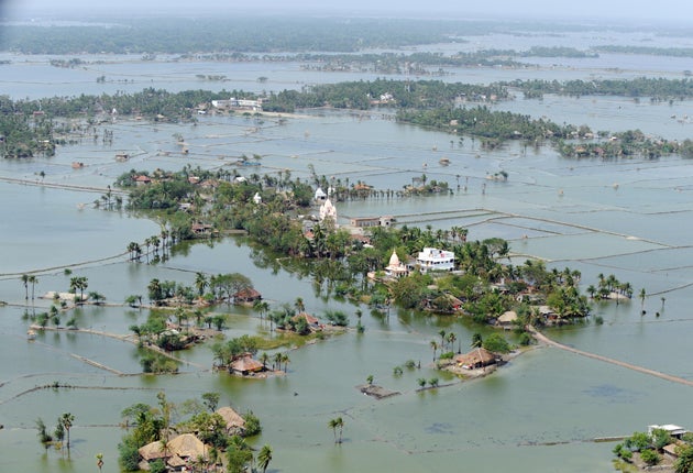
Rising seas claim island at centre of 30-year dispute
India and Bangladesh will fight no more over speck of land in Bay of Bengal

Your support helps us to tell the story
From reproductive rights to climate change to Big Tech, The Independent is on the ground when the story is developing. Whether it's investigating the financials of Elon Musk's pro-Trump PAC or producing our latest documentary, 'The A Word', which shines a light on the American women fighting for reproductive rights, we know how important it is to parse out the facts from the messaging.
At such a critical moment in US history, we need reporters on the ground. Your donation allows us to keep sending journalists to speak to both sides of the story.
The Independent is trusted by Americans across the entire political spectrum. And unlike many other quality news outlets, we choose not to lock Americans out of our reporting and analysis with paywalls. We believe quality journalism should be available to everyone, paid for by those who can afford it.
Your support makes all the difference.A low-lying island in a sprawling mangrove delta which has been disputed by India and Bangladesh for almost 30 years will be squabbled over no more. It has disappeared beneath the waves.
In what experts say is an alarming indication of the danger posed by rising sea levels brought about by global warming, New Moore Island has become totally submerged. "It is definitely because of global warming," said Professor Sugata Hazra of Jadavpur University in Kolkata. "The sea level has been rising at twice the previous rate in the years between 2002 and 2009. The sea level is rising in accordance with rising temperatures."
Known as New Moore Island in India, and South Talpatti in Bangladesh, the uninhabited outcrop in the Sundarbans delta region measured barely two miles in length and one-and-a-half miles in width. Yet the island had been angrily disputed by the two countries, almost ever since Bangladesh secured independence from Pakistan in 1971.
In 1981, with high-level meetings failing to resolve the matter, Delhi dispatched the armed frigate INS Sandhayak and a small military team to erect an aerial mast and the Indian flag. Bangladesh lodged a high-level protest, saying that the island was an integral part of its territory.
The problem in resolving the issue was that the flashpoint island was situated directly beneath the mouth of the river Hariabhanga, which marked the agreed international boundary between the two countries. Technically, possession of the island depends on which side of the island the main channel of the river flows. That has never been agreed by the two countries.
Yet such vagaries of ocean flow no longer matter. Mr Hazra said the island, first noticed in 1974 and possibly created by a massive cyclone that tore across Bangladesh, was no longer visible on satellite imagery.
The disappearance of New Moore Island, which was never more than two metres above sea level, may be a doom-laden portent for many islands in the delta. Professor Hazra said countless other islands were threatened by sea levels that for the past decade have been rising by around five millimetres a year. Before that, they were rising by around three millimetres a year.
Indeed, several islands in the Bay of Bengal have already had to be abandoned. The island of Lohachara was abandoned in 1996, while 48 per cent of Ghoramara is reportedly underwater. Thousands of so-called climate-change refugees have already fled. At least 10 other islands are said to be immediately at risk.
Bangladesh, with a population of around 160 million, may be one of the countries most vulnerable to climate change. Officials have estimated that around 20 per cent of its coastal area could become submerged and up to 20 million people forced to move if sea levels rise by one metre by 2050, as some climate-model projections have predicted.
Last month, a report issued by the World Wide Fund for Nature warned that the sensitive Sundarbans ecosystem, made up of mangrove forest and home to many tigers, could be swallowed up by rising tides within 60 years.
Join our commenting forum
Join thought-provoking conversations, follow other Independent readers and see their replies
Comments