Rail strikes: How a free walking map is helping people get to work without the Tube
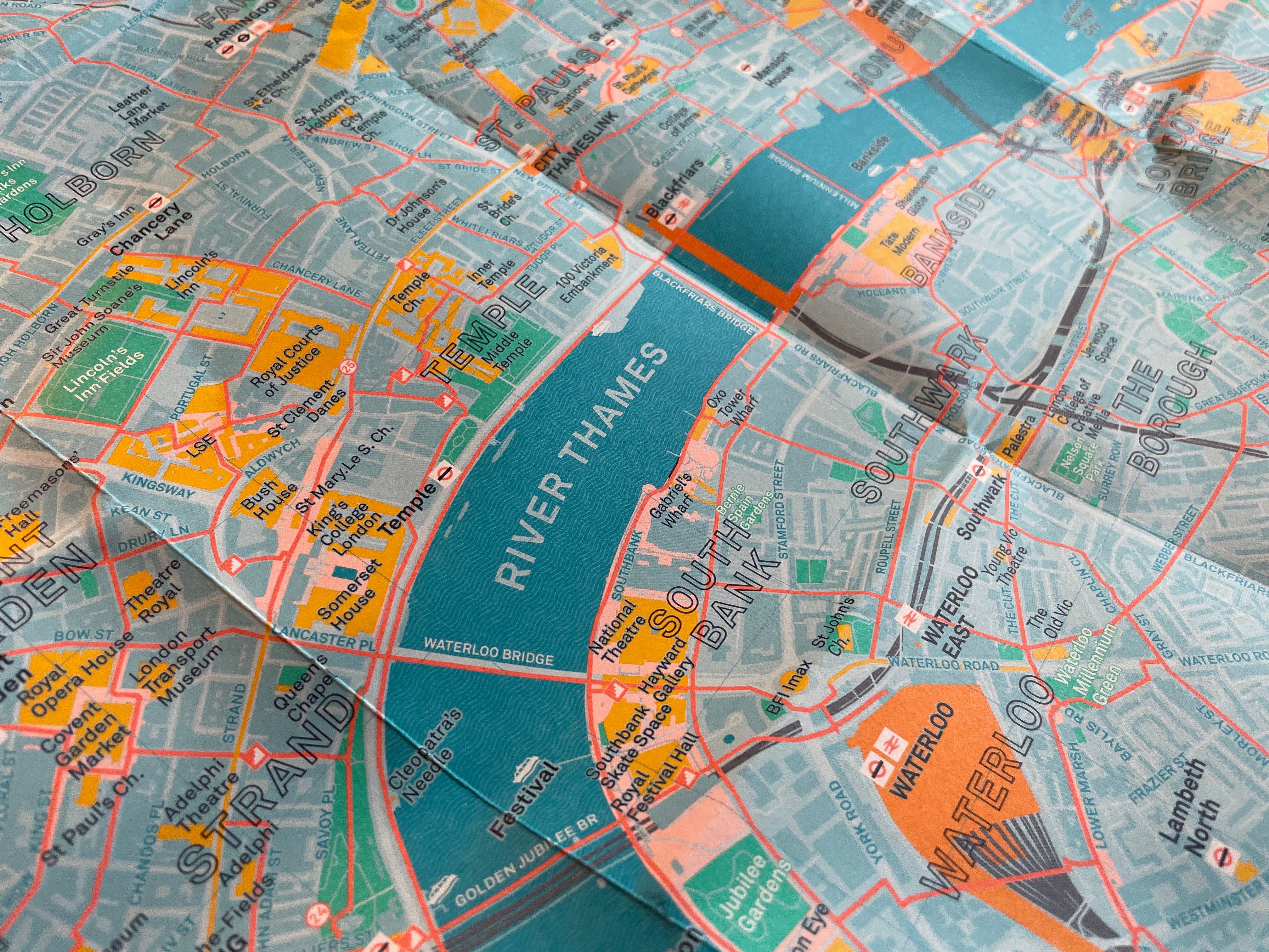
The London Footways map shows pleasant and direct routes through the capital’s backstreets

Your support helps us to tell the story
From reproductive rights to climate change to Big Tech, The Independent is on the ground when the story is developing. Whether it's investigating the financials of Elon Musk's pro-Trump PAC or producing our latest documentary, 'The A Word', which shines a light on the American women fighting for reproductive rights, we know how important it is to parse out the facts from the messaging.
At such a critical moment in US history, we need reporters on the ground. Your donation allows us to keep sending journalists to speak to both sides of the story.
The Independent is trusted by Americans across the entire political spectrum. And unlike many other quality news outlets, we choose not to lock Americans out of our reporting and analysis with paywalls. We believe quality journalism should be available to everyone, paid for by those who can afford it.
Your support makes all the difference.Hundreds of thousands of people will pour off commuter trains to London on Friday – to be met with a Tube strike. But some will be getting to work with the help of a new map that hopes to get more people stretching their legs around the capital.
The London Footways maps, which has been backed by Transport for London and Network Rail, was put together by two walking campaigners David Harrison and Emma Griffin with the goal of showing just how pleasant – and quick – strolling through the capital can be.
"It was the sight of all these people during a Tube strike queuing for a bus and complaining that it was taking them hours to get to work because they were waiting for so long," Harrison tells The Independent.
"It struck me that they could actually have walked it in far less time than they spent waiting at the bus stop, and they probably just didn't realise that."
Occasional visitors to London can often be bewildered by the scale of the city, and assume they need to get the Tube everywhere. But the pair developed the map to show that it can be just as quick – and sometimes a lot more pleasant – just to walk.
Over 15,000 people have picked up free copies of the latest edition of the map at eight central London railway stations in the first two weeks it was available, with information officers reporting back that they were "going like hotcakes".
Harrison and Griffin researched and put together the map together during lockdown, drawing out a network of walking routes through London's curious backstreets and tranquil Georgian squares calibrated for their directness, but also their picturesque quality.
Griffin, a marathon runner, jogged the outermost reaches of the routes to make sure they met their exacting quality standards, and they enlisted the help of professional designers to make the map easy to read.
As well as paper versions available in stations, an online version of the map is also available on the London Footways website, a service which has been used 1.3 million times.
Stations distributing maps for free include Waterloo, Kings Cross, Liverpool, Euston, London Bridge, Paddington, Victoria, Charing Cross.
"We provided them with an initial 10,000 copies and that went in about two to three weeks. We had huge enthusiasm – people saying this is what we've been looking for," Harrison says.
"Now the maps are available in all the information desks. After the initial 10,000 went Network Rail bought another 10,000 from us, which has been great and means we've been able to go a little further in covering our costs."
The dense network of handpicked routes stretches across central London from Paddington to Whitechapel and Walworth to Camden .
Particular attention is paid to linking up mainline stations, and major landmarks are picked out on the map in a different colour to help with navigation.
The map recommends, for example, eschewing the polluted Euston Road for the tree-lined Bidborough Street – with its wide pavements and lack of traffic. Cobbled, traffic-free Carter Lane, is recommended as a pleasant alternative to the race-track of Ludgate Hill. The map also points out little-known shortcuts, like a route through a public area by the BBC's New Broadcasting House.
"So much of London is much closer than you think. In a 20 or 30 minute walk you can get from mainline stations to many useful destinations. It's not that far to walk from King's Cross to the Strand and I think when people do it they're surprised how London is together," Harrison says.
"There have been huge improvements in central London especially when you get away from the main roads – and people will also be surprised quite how pleasant it is. It just needs a slight change in habit and mindset.
"I think if through the strike, painful though it is is, they try walking they might do it more frequently."
Join our commenting forum
Join thought-provoking conversations, follow other Independent readers and see their replies
Comments