Satellite images capture Florida before and after Hurricane Idalia made landfall
Florida Highway Patrol said that two men were killed in two separate weather-related road accidents. In Georgia, a man was killed by a falling tree while he was trying to clear another tree off a highway
Your support helps us to tell the story
From reproductive rights to climate change to Big Tech, The Independent is on the ground when the story is developing. Whether it's investigating the financials of Elon Musk's pro-Trump PAC or producing our latest documentary, 'The A Word', which shines a light on the American women fighting for reproductive rights, we know how important it is to parse out the facts from the messaging.
At such a critical moment in US history, we need reporters on the ground. Your donation allows us to keep sending journalists to speak to both sides of the story.
The Independent is trusted by Americans across the entire political spectrum. And unlike many other quality news outlets, we choose not to lock Americans out of our reporting and analysis with paywalls. We believe quality journalism should be available to everyone, paid for by those who can afford it.
Your support makes all the difference.Satellite images have captured the life-threatening flooding in Florida after Hurricane Idalia battered the peninsula this week.
Idalia made landfall in Florida’s Big Bend as a Category 3 storm early Wednesday morning with wind speeds topping 125 mph.
The storm flooded streets, destroyed homes and downed power lines. Terrifying videos have shown a car being flipped into the air by a gust of wind and a gas station roof being blown off.
Water levels in the Steinhatchee River surged from 1 foot to 8 feet in just an hour, the National Weather Service said.
The storm was declared “an unprecedented event” by the National Weather Service in Tallahassee, because no major hurricanes on record have ever passed through the bay abutting the Big Bend.
At least three people have so far been killed in the extreme weather, with Florida Highway Patrol revealing that two men died in two separate weather-related road accidents on Wednesday morning.
Meanwhile in Georgia, a man was killed by a falling tree while he was trying to clear another tree off a highway.
As of 5am ET on Thursday morning, the National Hurricane Center said that flooding due to heavy rains and strong winds would continue to ravage coastal North Carolina throughout today.
Idalia is then expected to chart its path out into the Atlantic later on Thursday.
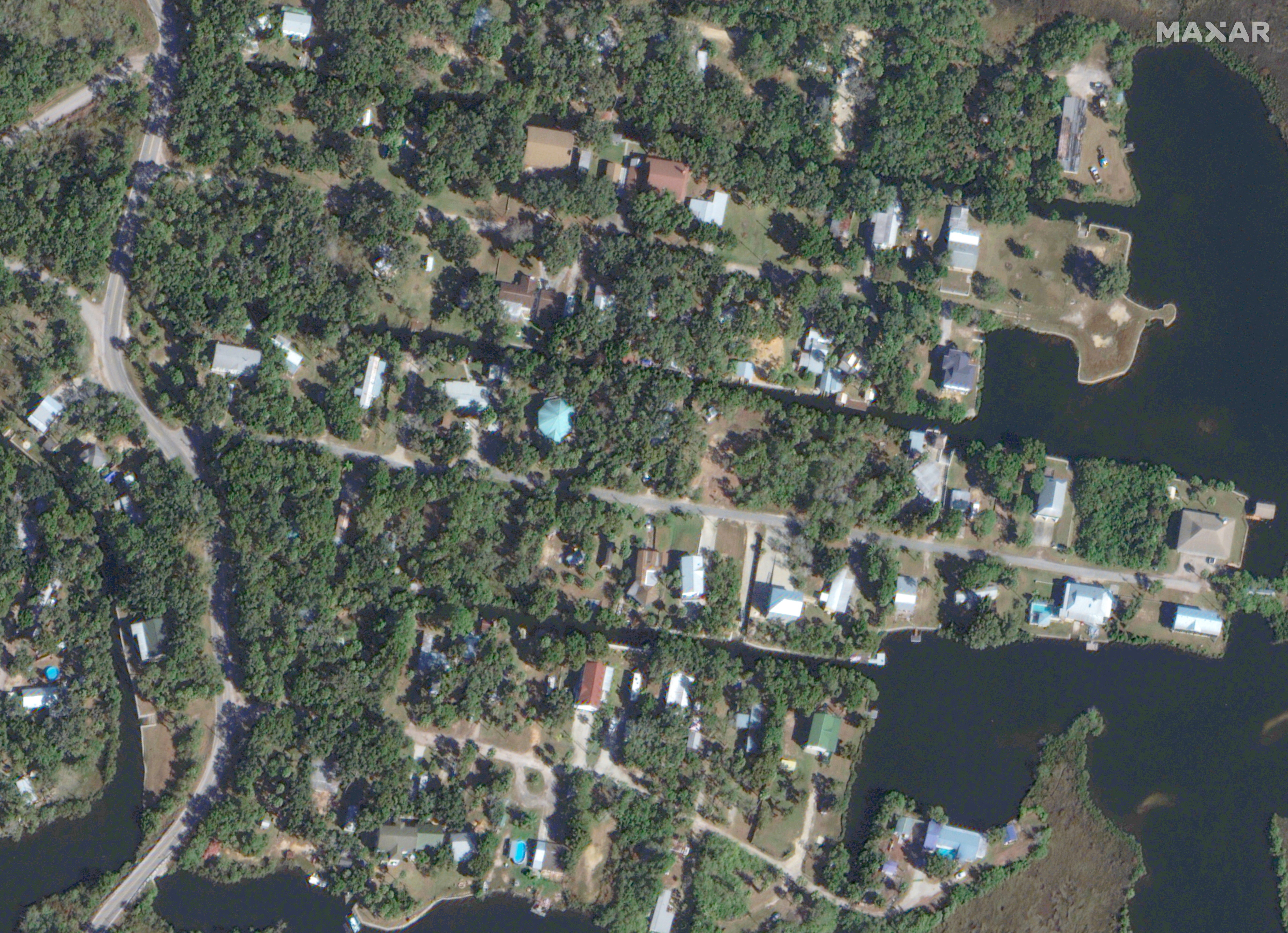
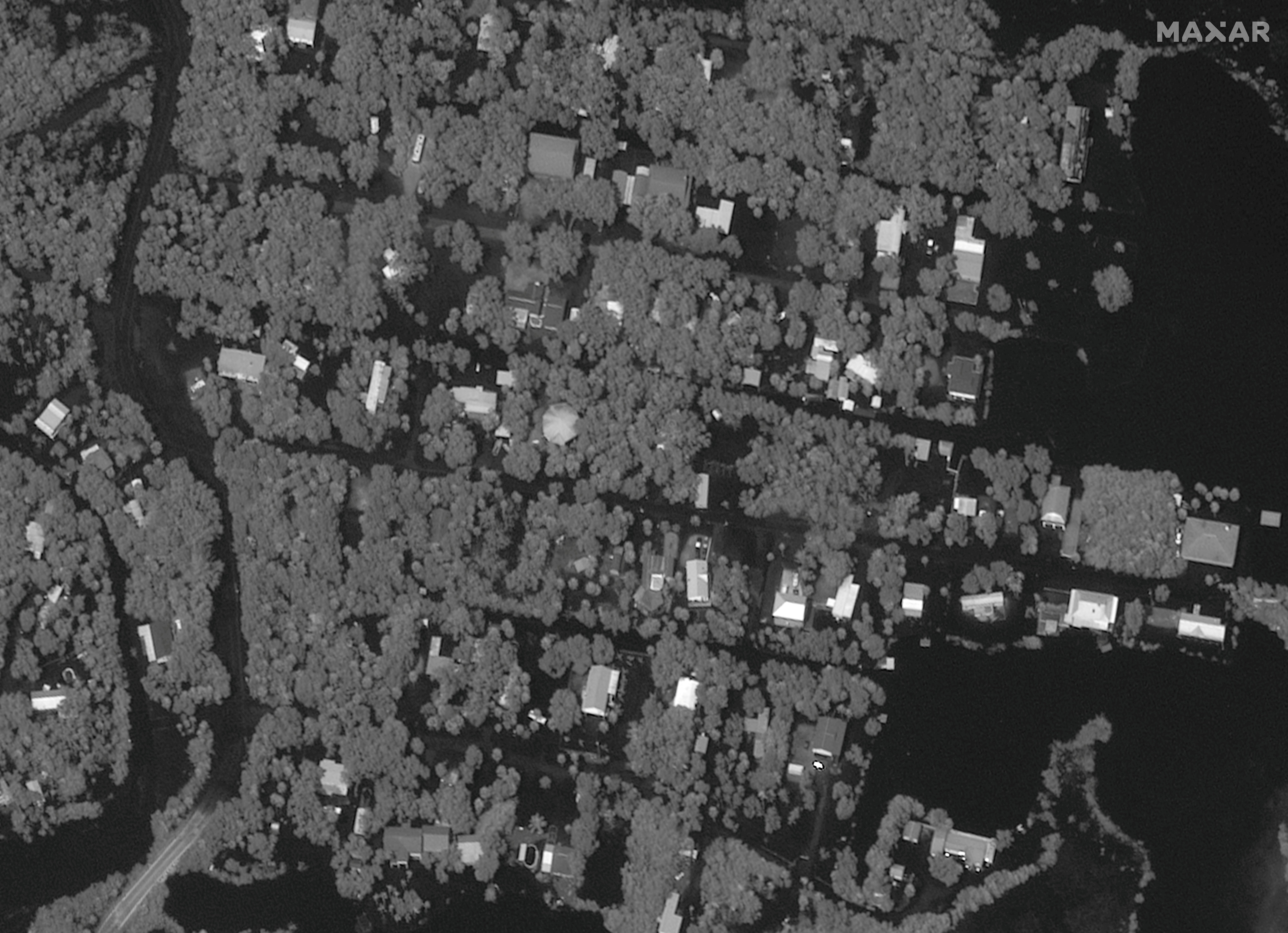
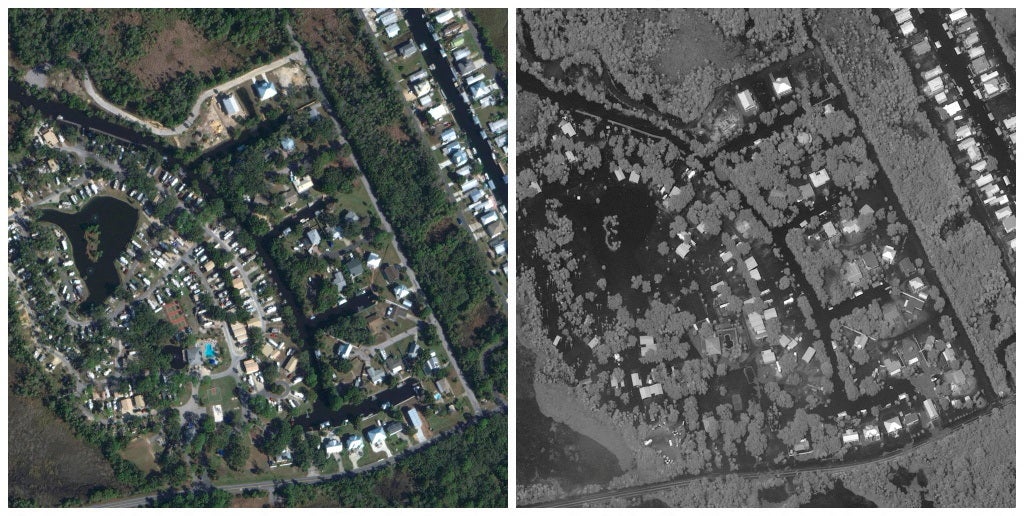
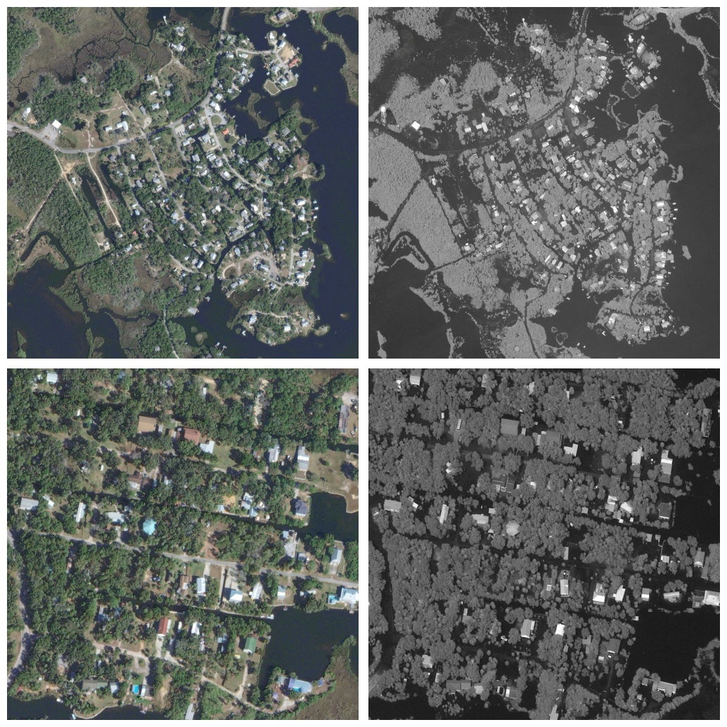
Florida has now begun its recovery efforts after the storm passed through on Wednesday, with shocking satellite images showing the extent of the damage.
Before and after satellite images showed how Ozello, an unincorporated community in Citrus County, Florida, flooded within hours:


Images also captured the stark difference between Florida’s Crystal River in January and the same area after the storm:

A combination picture shows satellite images of Ozello before flooding and after flooding:


Join our commenting forum
Join thought-provoking conversations, follow other Independent readers and see their replies
Comments