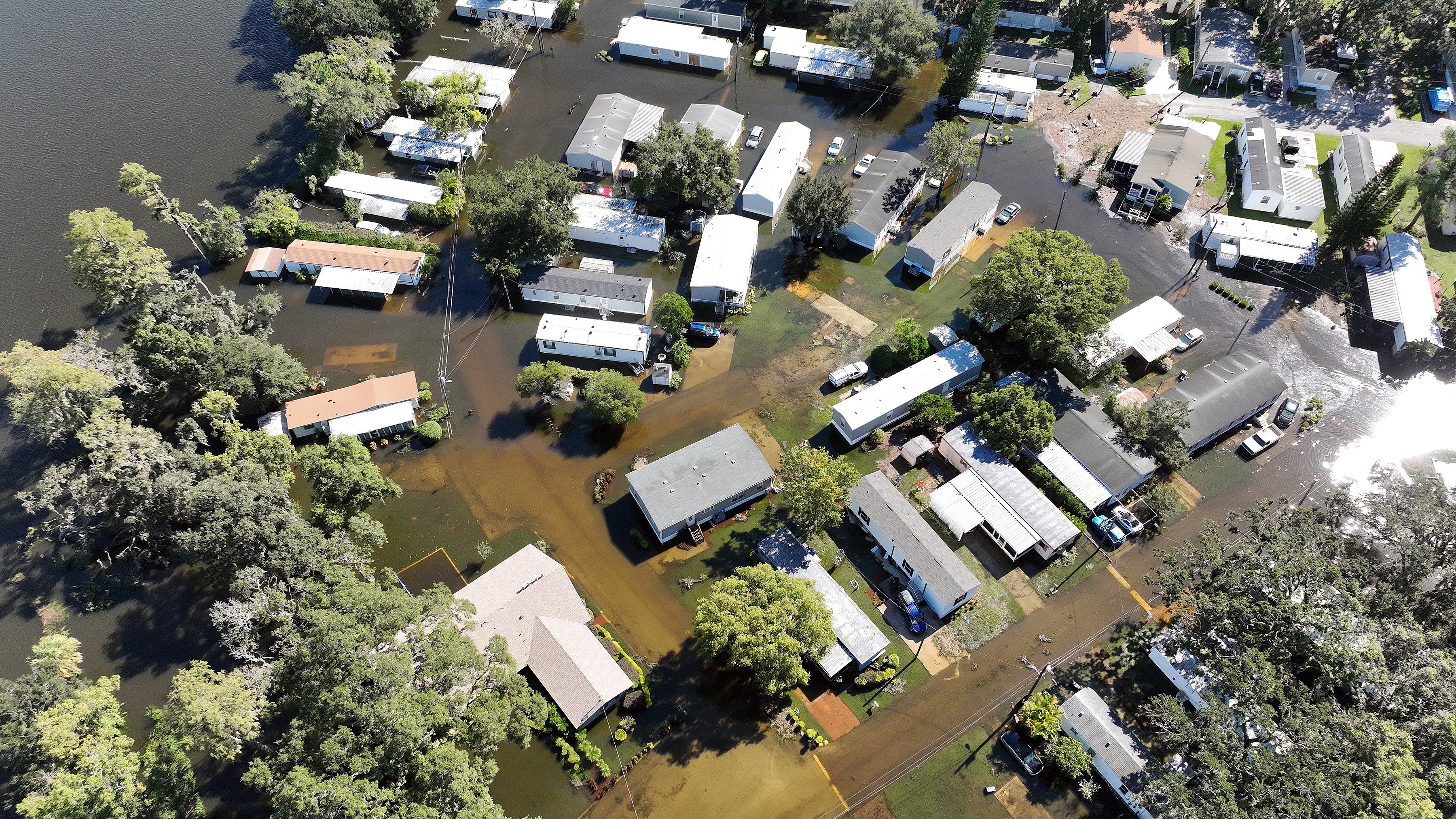
Hurricane Ian makes landfall in South Carolina
Ian roared ashore as a Category 1 storm near Georgetown, 60 miles north of Charleston
Your support helps us to tell the story
From reproductive rights to climate change to Big Tech, The Independent is on the ground when the story is developing. Whether it's investigating the financials of Elon Musk's pro-Trump PAC or producing our latest documentary, 'The A Word', which shines a light on the American women fighting for reproductive rights, we know how important it is to parse out the facts from the messaging.
At such a critical moment in US history, we need reporters on the ground. Your donation allows us to keep sending journalists to speak to both sides of the story.
The Independent is trusted by Americans across the entire political spectrum. And unlike many other quality news outlets, we choose not to lock Americans out of our reporting and analysis with paywalls. We believe quality journalism should be available to everyone, paid for by those who can afford it.
Your support makes all the difference.Hurricane Ian made landfall for the third time this week in South Carolina after tearing a ruinous path across Florida and Cuba.
Ian roared ashore as a Category 1 storm near Georgetown with sustained winds of 140km/h (85mph) at 1405 (eastern time) on Friday. The small town is around 96km (60 miles) north of the city of Charleston.
The National Hurricane Center (NHC) warned of life-threatening storm surge, damaging winds and flash flooding to the coast of the Carolinas amid heavy downpours.
The storm accelerated as it moved towards the coast and is traveling north at 24km/h (15mph), a National Weather Service spokesman said on Friday.
A hurricane warning was in effect from the Savannah River outside of Savannah, Georgia, up to Cape Fear, North Carolina.
A storm surge warning was issued for the Savannah River up to Cape Fear along with the Neuse River, North Carolina and St Johns River, Florida.
Ian is forecast to turn northwest on Friday night and will move inland across eastern South Carolina and central North Carolina into Saturday, according to the NHC. The system should weaken rapidly after landfall and become a post-tropical cyclone overnight before dissipating over western North Carolina or Virginia late on Saturday.
More than 300,000 people were without power in North Carolina and South Carolina on Friday, according to tracker poweroutage.us.
From early Friday, Charleston was battered by strong winds as people sheltered indoors and residents packed doorways with sandbags.
The NHC warned that at high tide, peak storm surge could be 4ft to 7ft along a 130 miles (205km) stretch from Isle of the Palms, north of Charleston, to Little River Inlet, north of Myrtle Beach.

The hurricane first made landfall on Tuesday in western Cuba, plunging the entire island into blackout after the power grid collapsed.
Ian then gathered steam in the warm Gulf waters and plowed in southwest Florida near Fort Myers on Wednesday afternoon as a near Category 5 hurricane with 155mph winds. Forecasters had warned of storm surge up to 18ft and preliminary data showed some record highs. Nearly 20 inches of rain fell in some places.
President Joe Biden issued an emergency declaration for South Carolina following his previous order for Florida. He warned that Ian could be the deadliest hurricane in the state’s history.
“I want to tell the people of Florida, we see what you’re going through and we’re with you,” the president said on Friday. He also urged residents of South Carolina to heed warnings from public officials about the dangers.
At least three dozen deaths are potentially linked to the storm, Florida officials said, with some reports confirming at least 17 deaths.
Many of the deaths were drownings, including that of a 68-year-old woman swept away into the ocean by a wave. A 67-year-old man who was waiting to be rescued died after falling into rising water inside his home, authorities said. Other storm-related fatalities included a 22-year-old woman who died after an ATV rollover from a road washout and a 71-year-old man who fell off a roof while putting up rain shutters. An 80-year-old woman and a 94-year-old man who relied on oxygen machines also died after the equipment stopped working during power outages.
Another three people died in Cuba earlier in the week as the storm churned northward. The death toll was expected to increase substantially once emergency officials have an opportunity to search many of the hardest-hit areas.
The US Coastguard and partner agencies continued to search for survivors with dozens of people being rescued. Thousands of people remained stranded with some residents airlifted from their roofs after high waters made whole neighbourhoods impassable.
In other places, rescue crews picked up people by boat and waded through waterlogged streets. Florida governor Ron DeSantis said rescuers have knocked on the doors of more than 3,000 homes in the most-affected places. “There’s really been a Herculean effort,” he said on Friday during a news conference in Tallahassee.
More than 2 million people in Florida were without power on Friday. One early estimate put economic losses at $120bn for the state.
While no stranger to hurricanes, Florida is one of the states most at risk from flooding linked to the climate crisis in the coming decades, the nonprofit First Street Foundation reported.
Rapid analysis, published by researchers at Stony Brook University and Lawrence Berkeley National Laboratory on Thursday, shows that human-induced climate change increased Ian’s extreme rain rates by more than 10 per cent, the nonprofit Climate Signals said in an email.
The climate crisis does not necessarily mean there will be more hurricanes in future. However, planet-heating greenhouse gas emissions, largely from burning fossil fuels, are driving hotter air and ocean temperatures that supercharge storms, making them more powerful and wet.


Join our commenting forum
Join thought-provoking conversations, follow other Independent readers and see their replies
Comments