100-degree heat is coming for the East Coast on Tuesday
After bearing down on the West, the eastern USA will expericing extreme temperatures this week with 140 million people under heat alerts
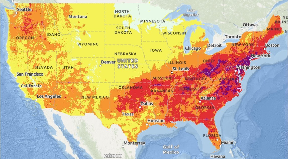
Scorching heat brought on by hot temperatures is forecast across much of the eastern half of the country this week, with some areas experiencing temperatures up to 100 degrees Fahrenheit (37 Celsius).
The extreme heat has put over 140 million people under heat alerts as of Monday in the East, after the West experienced dangerous record-breaking temperatures earlier this month.
Las Vegas experienced an extreme week of heat after witnessing a high temperature of 115F degrees (46C) on Friday, and a seven day streak of breaking or tying daily high temperatures.
But now, excessive heat warnings, watches, and advisories have been issued over parts of the Mid-Atlantic to New England, parts of the Central Southern Plains and Middle/Lower Mississippi Valley, and parts of the Western Ohio/Western Tennessee Valley, the National Weather Service has said.
The heat will expand its reach over portions of the central and eastern US this week, with near-record temperatures and high humidity possibly bringing “Major to Extreme Heat Risk” conditions for areas of the East on Monday and Tuesday.
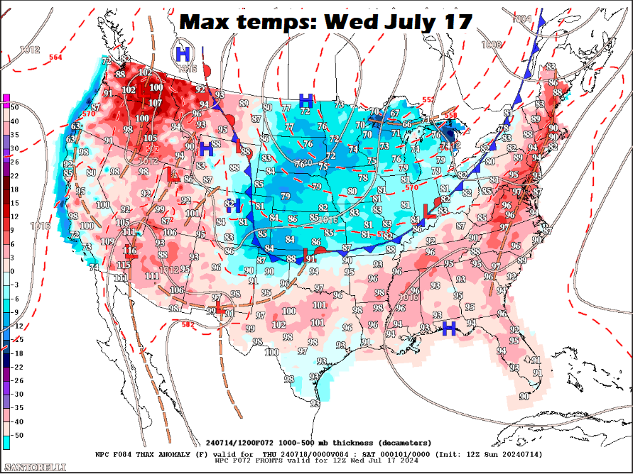
However, a cold front will bring relief from the northeast to the southeast this week. This large dome of cool air will come from Canada, bringing a “welcome relief” to the high heat across much of the eastern two-thirds of the country as the week progresses.
But until then, the weather experts ask citizens to stay safe in the ongoing heatwave.
In some areas, the NWS predicts that the heat could be extremely dangerous and potentially deadly, particularly for urban areas in the Southeast and East Coast, lasting from Monday through midweek.
Some daily record highs are possible for the East Coast and a number of warm overnight lows.
“Heat stress will build rapidly for those without adequate cooling or hydration,” the NWS said.

By Tuesday afternoon, heat and humidity are forecast to reach peak intensity over the eastern US, with an extreme heat risk expected for many areas of the Mid-Atlantic and the Ohio Valley.
Some daily records that have existed for hundreds of years are expected to be broken as the sweltering temperatures hit the region.
In some cases, such as Charlotte and Raleigh in North Carolina, daily record highs dating back to the 1800s will be challenged in the coming week, AccuWeather Meteorologist Reneé Duff said.
Dangerously hot heat index values of 110 degrees (43C) or higher can be expected in Raleigh Monday afternoon, their NWS station said.
The NWS in New York also said that hot and humid conditions will be experienced throughout the first half of the week, with temperatures expected to approach or exceed 100 degrees Monday through Wednesday.

This heatwave has already broken or tied some daily high temperature records in Washington D.C., with Washington Reagan National Airport recording 101F degrees (38C) on Sunday, beating its 1954 record of 100F (37C).
The states nearer the coast are not the only ones experiencing staggering temperatures this week.
Looking further inland, Tusla, Oklahoma’s weather experts are forecasting heat index values between 110-113F degrees (43C-45C) on Monday.
The dangerous heat wave has already borne down on the Western part of the United States and is suspected to have played a part in dozens of recent deaths, including that of a 10-year-old boy who collapsed while hiking in Arizona.
The NWS recommends that those who will be affected by the heat drink plenty of water, avoid alcohol, apply 30 SPF or higher sunscreen every two hours, wear lightweight, colored and loose-fitting clothes, and take regular breaks in the shade.
Join our commenting forum
Join thought-provoking conversations, follow other Independent readers and see their replies
Comments
Bookmark popover
Removed from bookmarks