Aerial photos show British homes lost to sea from decades of coastal erosion
Online catalogue used to track effects of climate change on Britain’s urban, rural and coastal landscapes
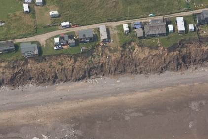
Striking new evidence shows the extent of coastal erosion in some of Britain’s most popular seaside areas, with historic and recent aerial images revealing the damage on homes and communities.
The images – published by the government’s Historic England department as part of the launch for its Aerial Photography Explorer – dated back to the 1920s in same instances.
The online map allows users, for the first time, to search and explore photographs of England from above over the last 100 years. As a result, they can be used to track the effects of climate change on Britain’s urban, rural and coastal landscapes.
It comes after a report by the Intergovernmental Panel on Climate Change (IPCC) warned earlier this month that the UK “is very much not adapted to climate change and not prepared”.
IPCC officials concluded that the worldwide impacts of the climate crisis were more severe than predicted, and there is only a narrow chance of securing “a liveable future for all”.
They also said that some coastal communities in the UK may have to move inland and that the number of people at risk of annual coastal flooding in the UK would rise from 3.2 million to more than 5 million in a worst-case scenario.
The online catalogue created by Historic England appears to substantiate these claims, with images from areas such as Norfolk and Yorkshire showing the already-advanced effects coastal erosion is having on those who live or own property by the sea.
In Happisburgh, Norfolk, the receding coast line’s journey has been well tracked from 1951 to 2021. It can be seen in the images below.
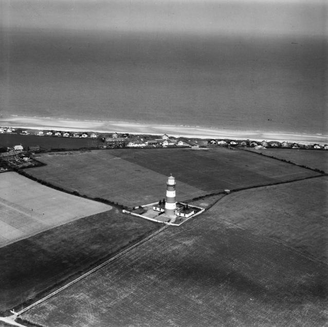
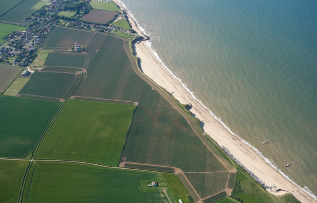
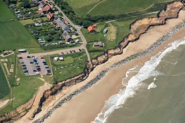
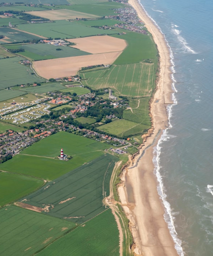
It can be seen in the 2021 image just how many houses are at risk of being lost to the ongoing erosion, and when compared with the 2009 photograph – it is clear just how quick the the landscape is changing.
Homes particularly along the north of Norfolk’s coast are susceptible to coastal erosion after a 2013 storm surge caused extensive damage to the coastline. Happisburgh sits along the east.
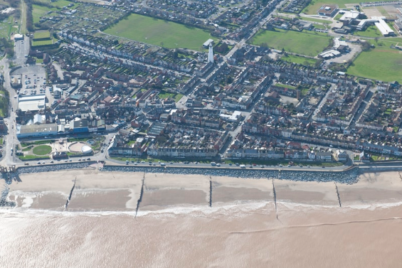
Pictures tell the same story in Withersea, Yorkshire, where images from 1925 and 2014 show how far back the sea has pushed, leaving an entire seaside community at risk.

Last month, it was announced that multi-million-pound work to protect more than a thousand homes on the Norfolk coast was scheduled to begin later this year.
Protective measures were announced for two stretches of the coast, at Cromer and Mundesley, with plans said to include the installation of steel sheet walls and concrete foundations, as well as rock protection and timber construction protections, according to local newspaper the Eastern Daily Press.
In 2018, the government laid out the UK’s second national adaptation programme, which it claimed would be delivered by 2023 and has since said includes “£5.2bn to tackle flooding and coastal erosion in the UK”.
After the publication of the latest IPCC report, Mike Morecroft, from government agency Natural England, stressed the importance of the coast to a country like the UK.
“As an island nation, what happens on the coast is a particular issue,” Mr Morecroft, one of the 234 lead authors of the study, said.
He also suggested restoring nature on the coasts, such as the example of the Steart salt marshes in Somerset, could provide “better protection than hard defences”, such as the ones being sought by the government.
Join our commenting forum
Join thought-provoking conversations, follow other Independent readers and see their replies
Comments


Bookmark popover
Removed from bookmarks