Historic London landmarks photos show how capital has changed from 1930s to now
Pictures show how London’s landscape has transformed over last century
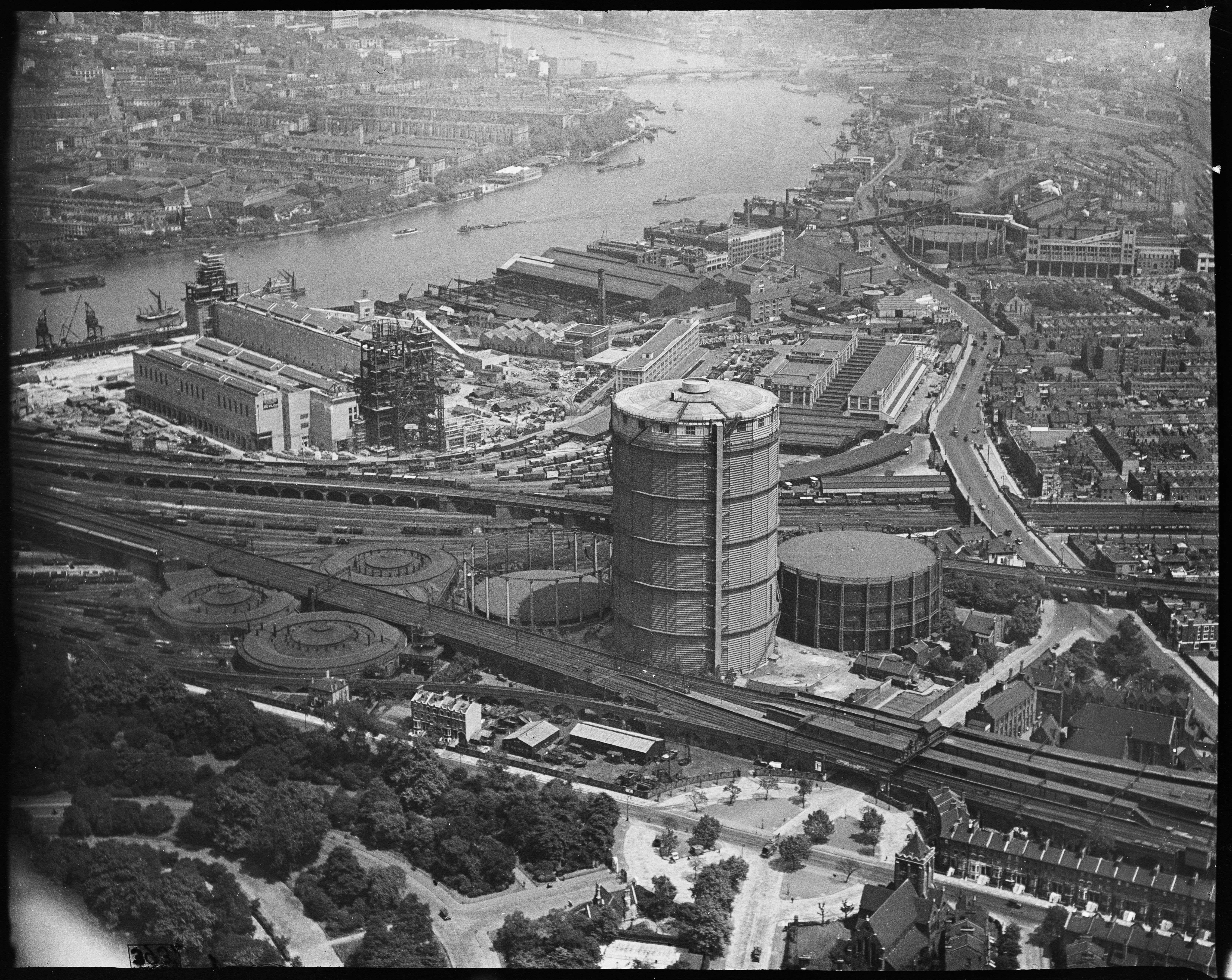
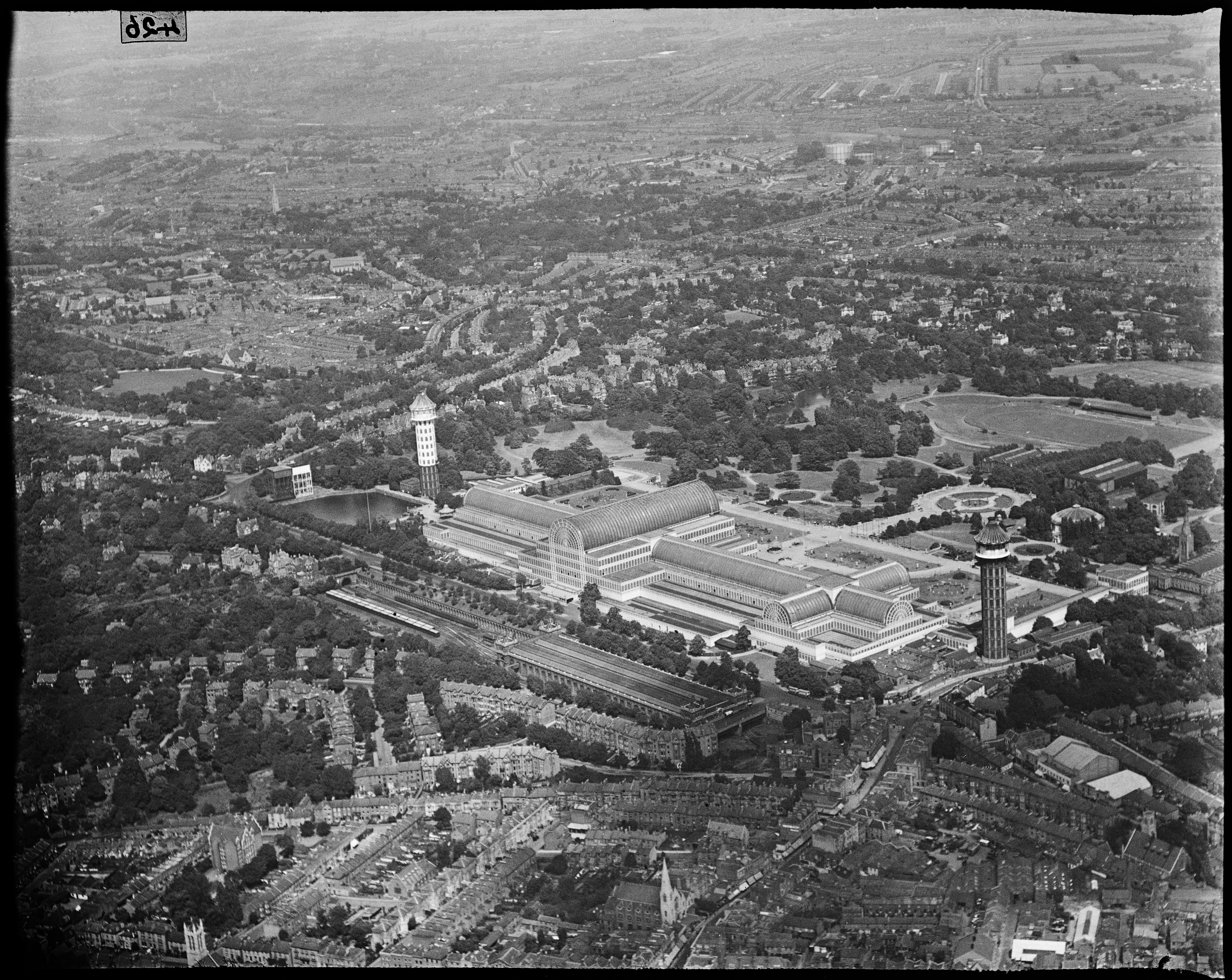
A newly digitised collection of photos have shown what historic landmarks looked like from the skies in 1930s interwar London.
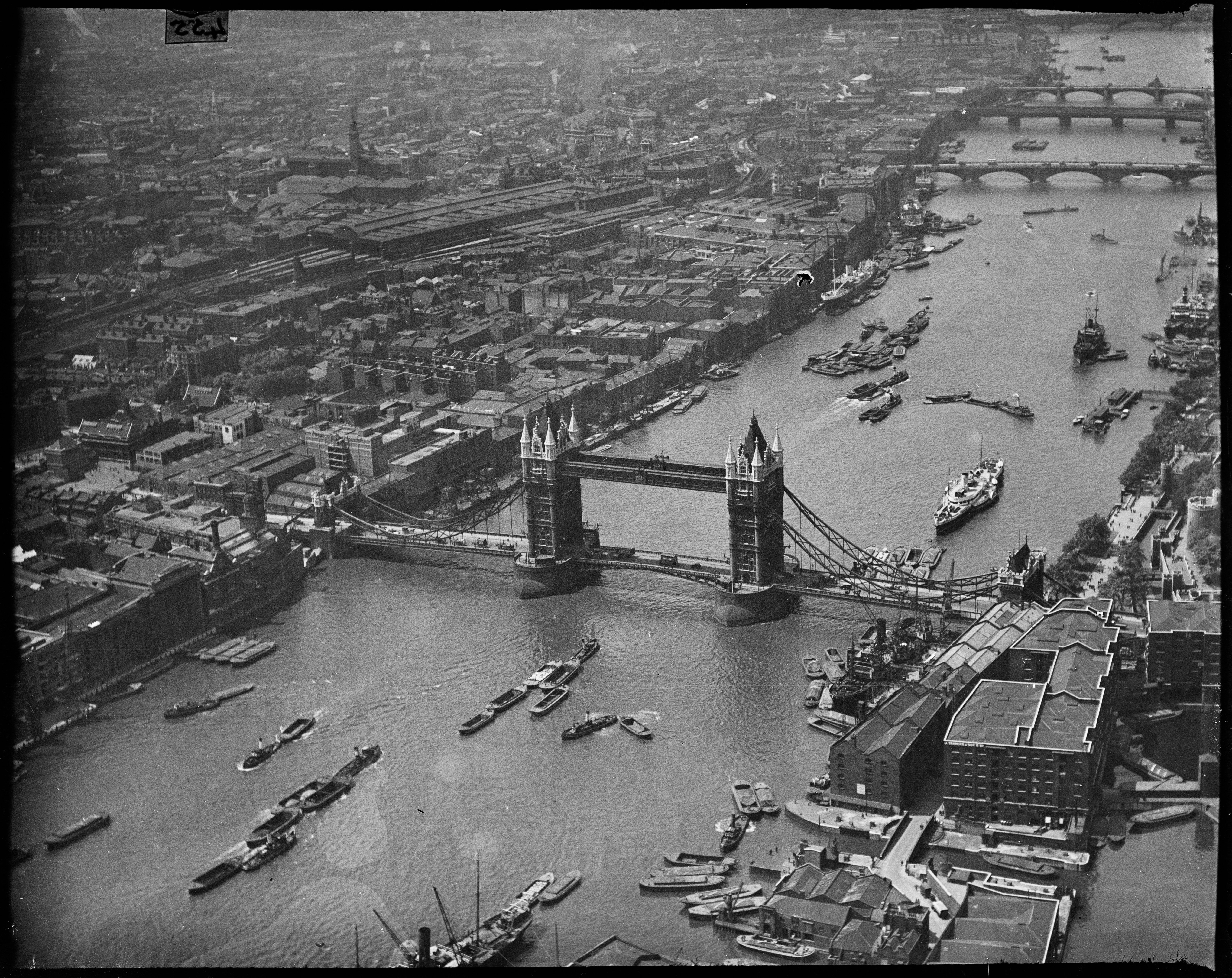
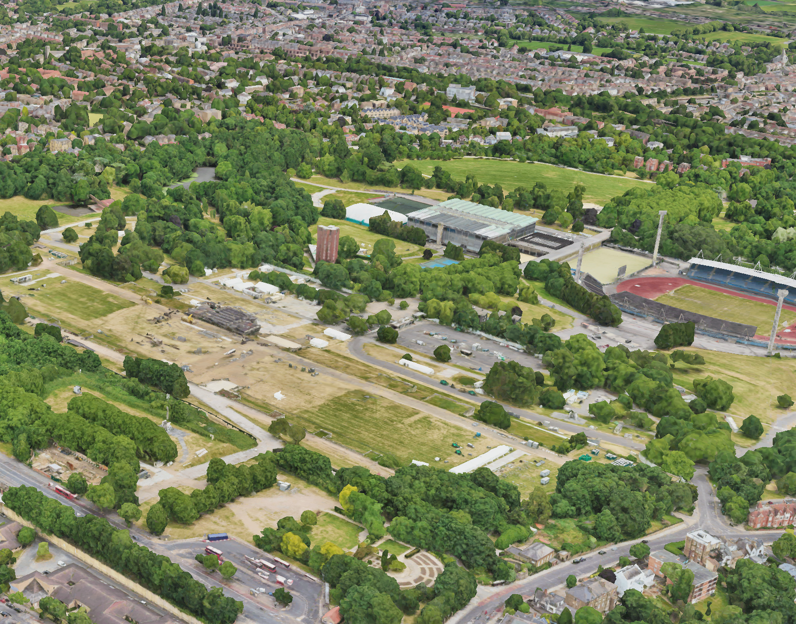
Taken in a time where Battersea Power Station was still under construction and the glittering structure of Crystal Palace still stood, the pictures taken by aerial photographer Arthur William Hobart show the transformation London’s landscape over the last 90 years.
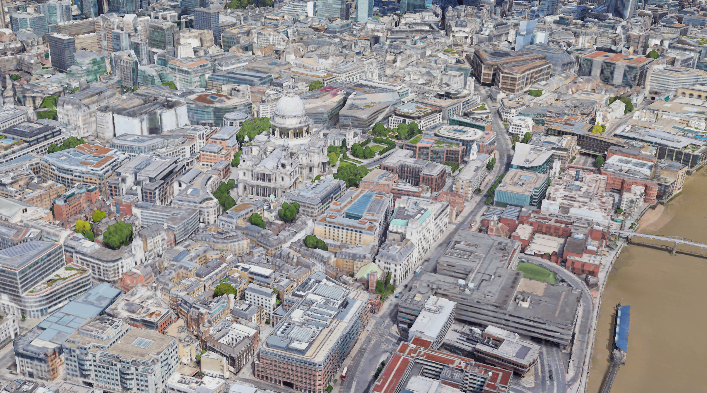
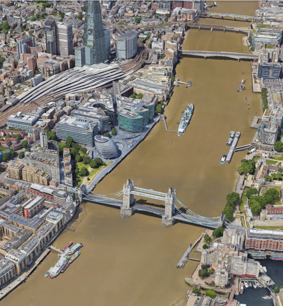
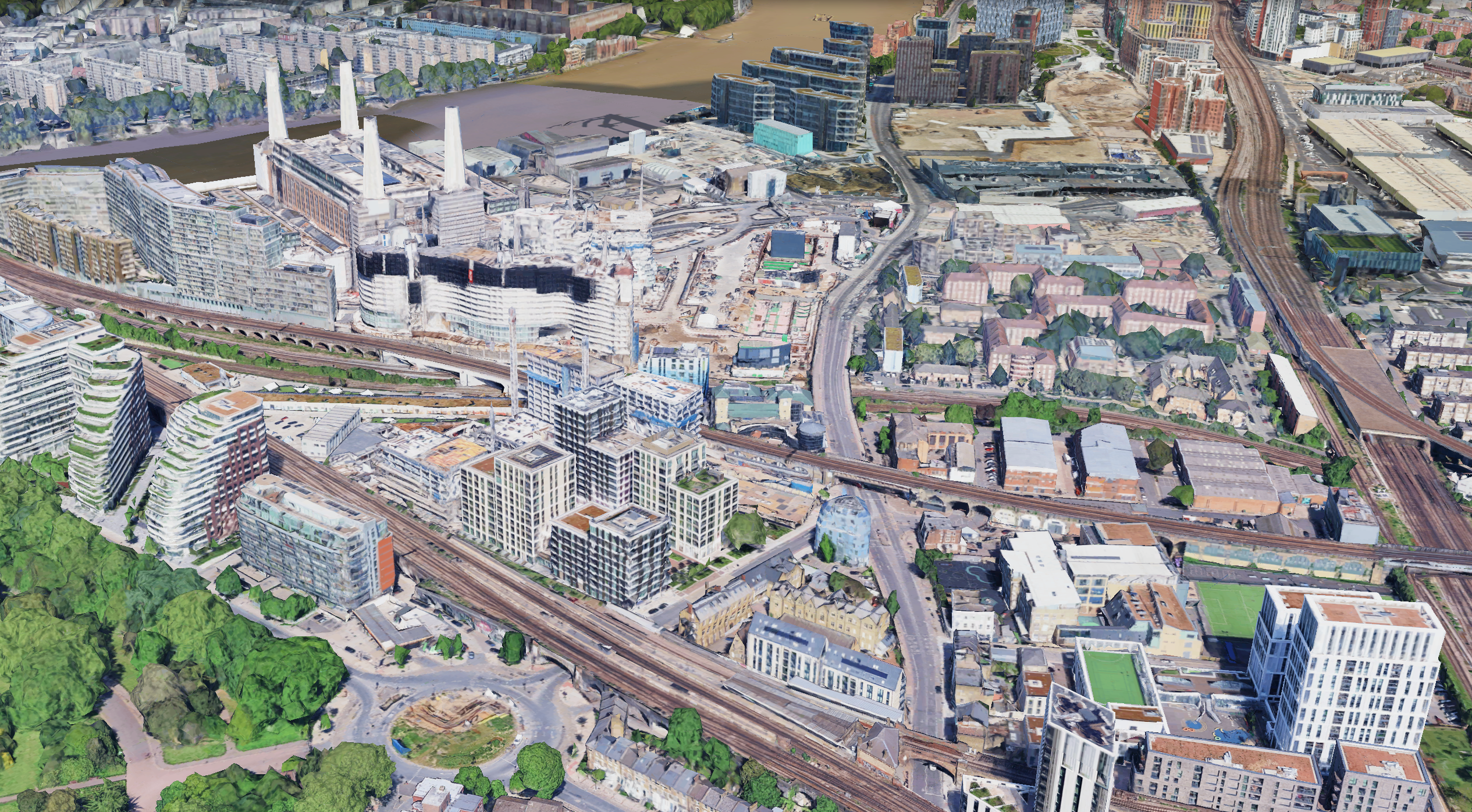
Other landmarks, such as St Paul’s Cathedral and Tower Bridge, remain much unchanged, though skyscrapers and new infrastructure have sprung up in the years since Hobart took to the skies.
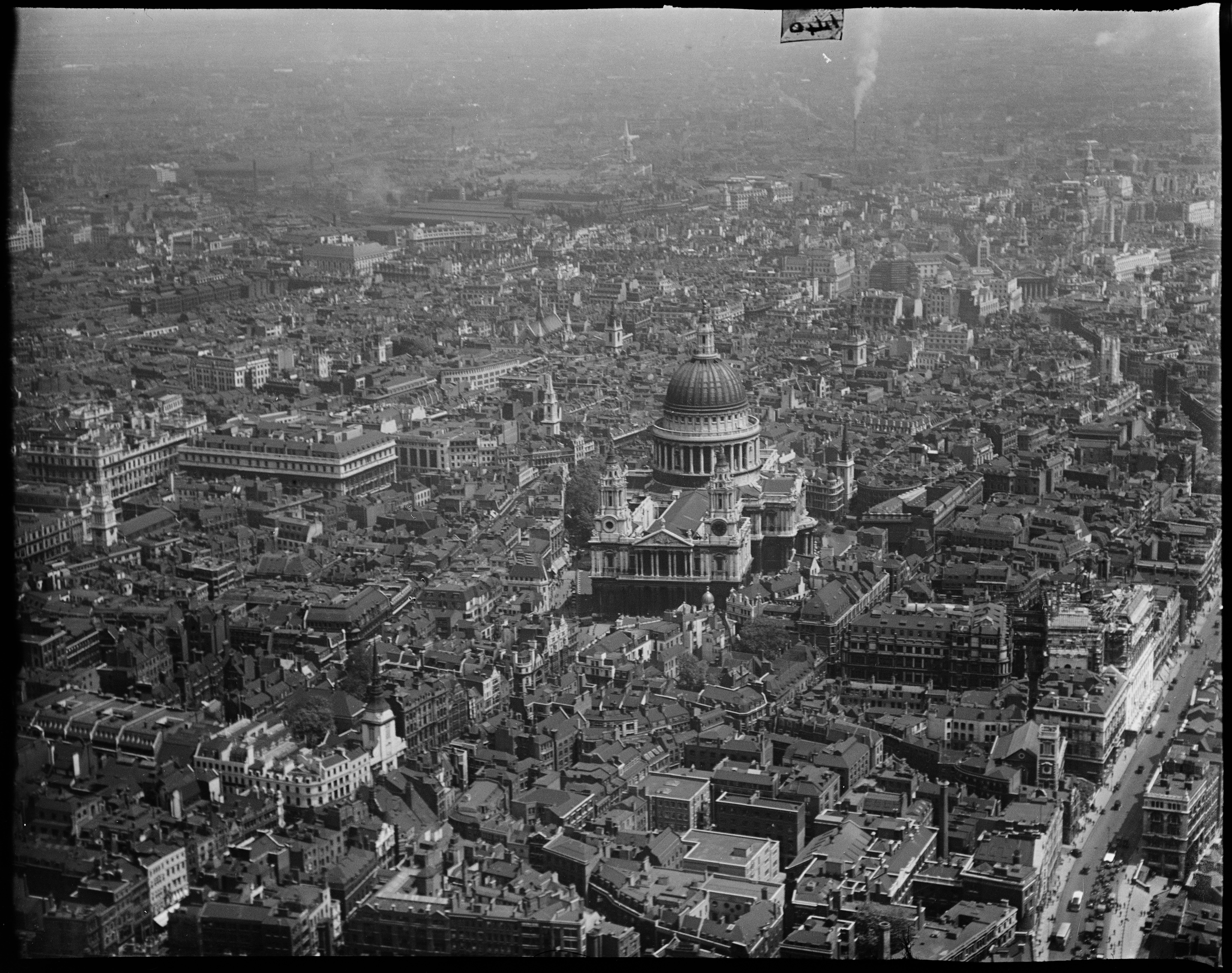
The collection features 242 black and white aerial images showing the national landmarks, towns, industrial sites, construction projects and seaside resorts of 1930s interwar England.
Published by Historic England on Thursday, the collection forms a part of a larger and mostly undiscovered body of Hobart’s aerial photography work, thought to be around 10,000 images.
Duncan Wilson, Chief Executive, Historic England said: “Flicking through these photos lets you take flight over 1930s England, to see the changing face of the country in the interwar period.
“Many of us will not have seen so many well-known landmarks and sites from this fresh perspective provided by aerial photography.
“We are the guardians of the largest national collection of aerial images in the country and hope that releasing this Collection helps inspire people to learn more about their local history through our online Aerial Photography Explorer tool.”
Born in 1882 in London, Arthur William Hobart was an early ‘commercial aerial photographer’ who started in the business around 1920.
In the 1930s, aerial photography was a young industry which emerged after the First World War.
This way of capturing new developments and industry of the time provides a fascinating and informative insight into a changing country. The collection shows how the business evolved to capture the interests and needs of this interwar decade.
To-date, no service record can be found for Hobart, however many early commercial aerial photographers had served during the First World War in aerial-related roles, and prior to the first World War he worked as a journeyman baker, commercial traveller and a draper’s clerk.
Photographs for postcards were Hobart’s largest market, but municipal authorities and the press were also principal clients. Photographs would have been taken on a commission basis, as well as speculatively.
Targeted for their unique selling point of providing views that people would not have been seen before, Hobart also appears to have been tapping into the emerging demand for aerial photos from other sources such as the construction industry and industrial sectors.
You can more of Hobart’s images and over 480,000 others from 1919 to the present day on Historic England’s Aerial Photograph Explorer platform.
Join our commenting forum
Join thought-provoking conversations, follow other Independent readers and see their replies
Comments
Bookmark popover
Removed from bookmarks