Storm Bert map: When and where UK will be hit by snow and winds after Met Office issue weather warning
The majority of the UK will be facing at least one weather warning in the days to come
Your support helps us to tell the story
From reproductive rights to climate change to Big Tech, The Independent is on the ground when the story is developing. Whether it's investigating the financials of Elon Musk's pro-Trump PAC or producing our latest documentary, 'The A Word', which shines a light on the American women fighting for reproductive rights, we know how important it is to parse out the facts from the messaging.
At such a critical moment in US history, we need reporters on the ground. Your donation allows us to keep sending journalists to speak to both sides of the story.
The Independent is trusted by Americans across the entire political spectrum. And unlike many other quality news outlets, we choose not to lock Americans out of our reporting and analysis with paywalls. We believe quality journalism should be available to everyone, paid for by those who can afford it.
Your support makes all the difference.The Met Office has warned Brits to prepare for a weekend of rain, wind and snow as Storm Bert sweeps the country.
Weather warnings are in place every day until Sunday – including more severe amber alerts – as the country braces for more wintry weather after temperatures plummeted earlier in the week.
The majority of the UK will be facing at least one weather warning in the days to come, with Scotland and northern England expected to be the worst affected.
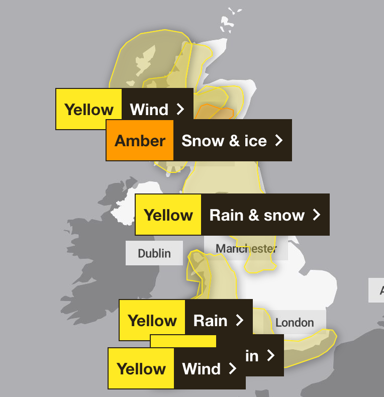
On Saturday morning, were in place as Storm Bert made its way across the UK.
An amber alert for heavy snow and ice was in force between 7am and 5pm on Saturday in an area north of Scotland’s central belt, where 10-20cm was forecast on ground above 200 metres and potentially as much as 20-40cm on hills above 400 metres.
A further ambert alert for snow was in force until midday, covering an area stretching from just north of Bradford and Harrogate to as far north as Peebles in the Scottish Borders, but was confined mainly to rural areas in central northern England.
Forecasters said power cuts and travel disruption were likely and there was a good chance some rural communities could become cut off.
A yellow weather warning for snow and rain in place from Saturday morning to Sunday morning also warned residents in much of Scotland, north-east and north-west England, the West Midlands and Yorkshire that there could be a danger to life as snow quickly thaws to rain.
There were also warnings for rain in south-west England and Wales, where in excess of 100mm of rain is expected to fall on higher ground, with as much as 150mm anticipated on parts of Dartmoor.
As of 3pm on Saturday, there remained seven yellow weather alerts in place, stretching the length of the UK, but mostly in western areas.
The entire south coast and much of western Scotland were subject to warnings for strong winds, with a rain alert in force in Wales until 6am on Sunday. Further rain alerts were issued in northwestern England and central Scotland.
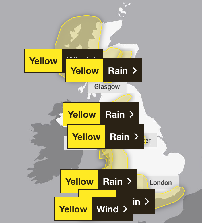
Met Office deputy chief meteorologist Dan Holley said: “Storm Bert marks a shift to much milder air and wintry hazards will gradually diminish through the weekend, but heavy snowfall is expected across parts of northern England and Scotland for a time on Saturday, especially over higher ground, and warnings are in place.
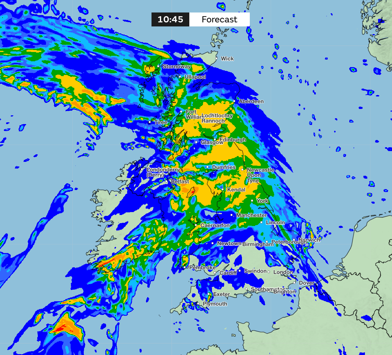
“Heavy rain through Saturday and Sunday, especially in southern and western parts of the UK, will also bring impacts for some with a number of warnings in place.”
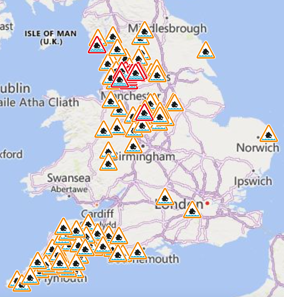
He added: “In addition, rapid melting of lying snow over the weekend and periods of strong winds are likely to exacerbate impacts and bring the potential for travel disruption, as well as flooding for some.”
Indeed, by 3pm on Saturday, there were 26 flood warnings in force in England, along with 83 lesser flood alerts. There were six flood alerts covering swathes of southern and eastern Scotland, and one warning in Orkney, while Wales was subject to 41 alerts and five warnings.
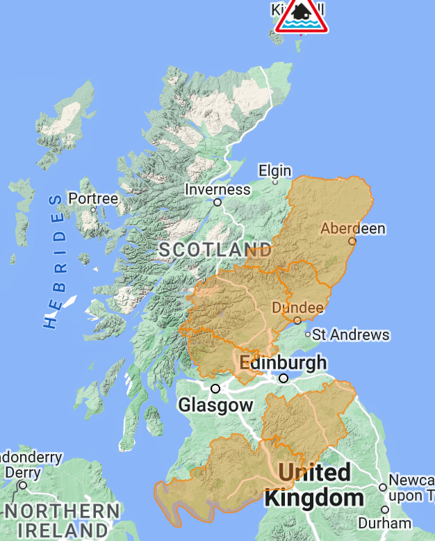
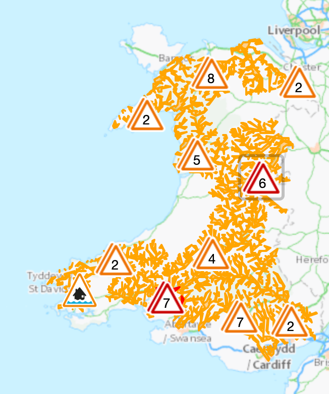
Unsettled weather is likely to continue into the start of next week, with strong winds and some showers for many parts. Although temperatures will be around average for most places, strong winds mean it will feel rather cold.
Looking further ahead, there are indications we could see a brief return to colder conditions with wintry showers for a time, especially in the north, before it becomes unsettled and milder again at the end of next week.


Join our commenting forum
Join thought-provoking conversations, follow other Independent readers and see their replies
Comments